We departed Coober Pedy early in the morning, hoping to get to Oodnadatta and The Painted Desert. Unfortunately roads through the Painted Desert were still closed as was the track south from Oodnadatta itself. Tony at the
Desert View offered us a very discounted rate if we wanted to stay another night, but we decided to set off to Oodnadatta via the Kempe Road. As it turned out, we should have taken Tony up on his kind offer.
 |
| Just a bit of water on the road |
The road to Oodnadatta was open to 4WD only, and at the first major creek of the track we found out why. Water was still over the road, and in places the floodways were still very boggy. More telling was the fuel consumption as we drove on a soft road - getting close to 18L / 100km on the 200km to Oodnadatta.
 |
| Oodnadatta Station - the former rail head of the Ghan Line |
 |
| Damn camera shake - at the iconic Pink Roadhouse - Oodnadatta |
At Oodnadatta (Australia's hottest and driest town) we enjoyed lunch with the old machinery on display near the old railway station. Oodnadatta was the rail head of the Ghan railway until the rail was pushed through to Alice Springs in the 1920s. We enjoyed a self guided tour of the museum in the old Station - and learnt a great deal about the community life living in such a remote area.
We had taken a gamble that the road south - the Oodnadatta Track would be open by the time we got there, however it was not to be. The road to The Painted Desert was also still closed, so we decided to make ground towards William Creek via none other than Coober Pedy. Yes, we backtracked, and after a quick refuel and ice cream we left Coober Pedy and headed east on the William Creek road. We ended up camping on the William Creek road, on a delightful creek about 100km east of Coober Pedy.
 |
| Boys would be happy camping anywhere - as long as it has dirt |
 |
| The flyscreen room was put to good use here |
 |
| We were checked out by the local dingos |
The following morning we made it to William Creek in good time, and enjoyed a quick look around town, before heading south on the Oodnadatta Track. The Track is linked closely to the old Ghan railway and much of the points of interest are linked to the railway. The Pink Roadhouse in Oodnadatta publish an excellent pamphlet detailing where most of the points of interest are, and we thoroughly enjoyed our drive south with our handy brochure.
 |
| Stuart Creek - the second longest bridge on the railway |
Highlights for me were seeing some of the railway bridges and sidings, with the desalination water plants for the steam engines. The railway was linked in those days closely with water, and seeing a map of the location of mound springs in the area, it becomes immediately apparent why this route was chosen. In many areas along the route, natural mound springs occur, which for thousands of years allowed the Aboriginal people to travel through otherwise inhospitable terrain. Stuart followed the Aboriginal routes, as did first the Overland Telegraph line and then the railway.
 |
| The ruins of the Strangeway Springs |
At the Strangeways Springs, we explored the ruins of one such telegraph station. The Overland Telegraph completed in 1872, represented the latest in telecommunication in its day. It connected with a cable in Darwin that was ultimately connected to London, meaning for the first time Australia was in direct communication with the outside world. The site was chosen after a pastoral lease closed, and it remained in operation for twenty years. Unfortunately the salt in the soil and water used to mix the motar has taken its toll, leaving most of the stone buildings in little more than piles of rubble. It was telling that the dry stone walls of the yards had stood the test of time in far better shape.
The telegraph poles used on the line were either native pine from the Flinders Ranges region, moved in by dray, or a special telescopic galvanised steel pole. We found some of the original poles further south, where later telephone wires were also strung from the line. And later we were to find some of the slow growing native pine on our visit to Arkaroola.
We stopped also for a dip and swim at Coward Springs. In the cooler months, this is a very popular campsite on the Oodnadatta Track. It is a compulsory stop for many - but as we had the place to ourselves, we took a few liberties not open to all who travel this way.
 |
| Taking a stroll to Coward Springs |
 |
| And the water was lovely in |
 |
| Then back on the road |
The natural history of this part of the world is all too apparent when we stopped nearby at the Mound Springs National Park. Due to numerous new bores being sunk over the past hundred and fifty years or so, many of the natural springs have dried up due to the loss in pressure. This has led to the loss of the natural habitat to many rare plants, snails and even fish that live in these springs.
This is none more apparent that at the Bubbler, where in its natural state, water bubbled up to half a metre above the surface. A tree in the spring, important in dream-time stories was cut down for firewood, the area around the spring trampled and the water pressure is now so reduced that all you see is the occasional bubble.
 |
| The Bubbler |
 |
| Blanche's Cup |
And then we went a bit further south- pulling off every now and then to check out a an old railway siding, or bridge. It was slow travelling, but so much fun.
 |
| Curdimurka Bridge - old Ghan line |
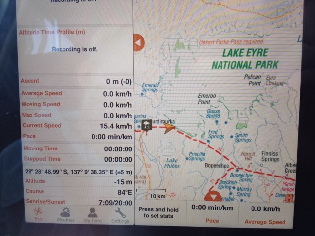
And then we pulled off to check out the view towards Lake Eyre. It was so exciting looking at the GPS altitude, that we sort of lost track of ourselves and I decided to nudge a little lower down the slope...
We were just pulled off the road, but the danger suddenly became all too apparent as we broke through the salty crust and started sinking in the mud. My right foot also sank to the floor and we all held our breath as we sank lower and lower and slithered closer and closer to the road an our salvation.
Somehow we made it and clawed our way back onto the track. Phew. It was time to change pants and take a photo!
 |
| At 15 metres below sea level! |
 |
| Phew - made it back on the track |
 |
| The tracks say it all! |
We camped on the track near Poole Creek, recently washed clean with the rains. We enjoyed a little explore up the creek. It was there I experienced one of those parenting moments best forgotten. As I was admonishing the boys for getting covered in mud, suddenly I found my feet gone from under me and it was me who was now in the mud. Ahhh. At least the boys got their laughs for the day.
We camped that night under a truly glorious sky - one that you will never see in the cities - or even at sea. Free from city lights, and clear air, the sky was ablaze with stars - and we could have sat up all night watching them.
 |
| Our delightful camp out of Maree |
 |
| Not a bad camp |
The next morning we got on the road and continued south - stopping for a look at Marree of one of Tom Kruse's (The Birdsville Mailman) trucks, and some of the old Ghan locomotives. Just out of Maree one floodway was a little muddy - and we got a good dose over Rocky, much to the boy's delight.
 |
| Muddy - Lovely salt encrusted mud |
 |
| The boys check out Tom Kruse's old truck - and appreciate some of Rocky's comforts |
We checked out the ruins of Farina - the wishful food bowl of South Australia. Of course the rains never came, the soil blew away and the town slowly fell into decay. The salt in the ground seeps into the buildings and destroys the mortar, causing them do crumble and decay. A team of volunteers work through the winter to restore this township - and the old bakery is fired up and bakes bread in the traditional way to feed the volunteers.
 |
| The ruins of Farina |
 |
| Farina ruins |
It was then short drive to Copely to buy a Quandong Pie and a resupply at Leigh Creek before heading east and on to the famous Arkaroola. We had loved our trip down the Oodnadatta track, but it was at Arkaroola we were about to experience a whole new connection with the land.


No comments:
Post a Comment